
An incredible Trekking in Australia…Move freely among deserts, canyons, national parks, and breathtaking landscapes!
This itinerary can be followed with a Bushcamper (off-road vehicle equipped for cooking and sleeping onboard). It will be possible to stop in the various campgrounds located in the places visited and normally managed by the Northern Territory Parks and Wildlife Commission. This could be the most comfortable option because it allows you to better manage the day since, having to dedicate yourself to walks that can take up to 4 hours. It is also possible to choose a normal off-road vehicle with overnight stay accommodation along the route in lodges, equipped safari tent, and resort. In this case, the itinerary will be modified to harmonize the walks with the transfer times.
Indicative kilometers traveled: 154 KM
Type of road: Asphalt/ white road
Permits required for parks crossing. Meerenie Loop Pass, AUD 5 available for purchase at Alice Springs Visitor Center; Glen Helen Resort; Hermannsburg Petrol Station, and a Kings Canyon Resort. Uluru pass valid for 3 days and multiple accesses to Uluru and Olgas Mountains AUD 27. Other entrances to local parks can be requested locally or, be a donation.
Trekking: 7 km
Overnight stay: Ormiston Campground or Glen Helen Lodge
Today's program;
Bushcamper withdraws and supplies. Departure along Larapinta Drive until you reach the crossroads for Ormiston Gorge. You reach the Visitor Center (caravan park available). From here you start the walk of about 7 km which will take you through the popular and splendid pool of Ormiston Gorge to the majestic rocky amphitheater of Ormiston Pound. You can stay overnight in the area or reach the nearby Glen Helen Lodge with accommodation in the hotel room and at the campground. Restaurant, shop, and fuel station available.
Indicative kilometers traveled: 250
Type of road: asphalt/ unpaved track
Trekking 5 km
Overnight stay: Kings Canyon Resort campground or Resort or Kings Creek Station
Today's program;
Today you start along the Meerenie Loop.
At about 20 km from Glen Helen there is the crossroads for Red Bank Gorge, only 5 km and then a nice walk.
This place is one of my favorites in West MacDonnell National Park. The gorge becomes a thin slit of rock where the cobalt blue sky fits like a blade into the rocks' bright red and pearly white. You can also take the walk on the top or cross the narrow gorge...Bring your swimsuit and towel! Not far Mt Sonder (1380m).
Another forty kilometers and you reach the crossroads of Ipolera, from where the Meerenie Loop Road begins. There are about 160 km of scenic and fascinating tracks, it is not difficult to travel but it must be taken calmly. At certain points, the rocky roughnesses have the shape of large dinosaurs that graze in the middle of the red of the Outback.
Indicative kilometers traveled: 297
Type of road: Asphalt road
Trekking: 6 km
Overnight: Ayers Rock Campground or press the resort
Breakfast excluded
Today's program;
Morning dedicated to an exploratory visit to Kings Canyon.
DESCRIPTION OF THE KINGS CANYON
Universally known as Kings Canyon, Watarrka National Park is a mighty rocky gorge that cuts through the earth to a depth of 270 meters. Located on the western spurs of the George Gill Ranges mountain range, it is located about 300 km north-east of the Uluru-Kata Tjuta national park. The park is an important area of protection of the environmental heritage and over 600 species of plants and many local animals can be discovered in its gorges. The red rock of the canyon, perpendicular to the ground, stands over 100 meters above lush palm trees and groves of incredible ferns, palms, and cicadaceae, protecting them from the aridity of the surrounding desert. You can take a walk of about 6 km along a circular route that can be done in 3-4 hours (you can stop it in the middle of the route). The first part is characterized by numerous steps. You will reach the top following the edge of the canyon to admire wonderful panoramas, beautiful buttressed rocks of Lost City, then descend through the Garden of Eden, a tropical oasis located in the depths of the canyon, characterized by pools of water and the intense green of the vegetation. At this point, a special staircase allows you if you want to interrupt the path and reach the base of the Canyon.
Indicative kilometers traveled: 60
Trekking: 7km
Type of road: Asphalt road
Today's program;
In the early morning reach the Olgas mountains to visit them. They are a series of 36 magnificent natural "domes" resulting from centuries of wind and rain erosion. Their Aboriginal name Kata Tjuta means the "place of many heads". The theory tells us that probably the Olgas were once a single huge monolith - larger than Ayers Rock - transformed and divided into many rounded mountains following natural phenomena. The most beautiful route is that of the Gole del Vento, the entire circuit that takes you back to the starting point lasts about 7 km with a degree of difficulty 4.
Afternoon dedicated to the Monolith of Uluru and its famous, inevitable sunset.
Ayers Rock is the symbol of Australia par excellence. This mysterious sand monolith, located 500 km south-west of Alice Springs, is 350 m high and 7.5 km wide. It is not a rock, but the tip of a conglomerate of pebbles, the bottom of what was once an inland lake about 600 million years ago. For the Aborigines, the Rock is the "sacred place of dreams", and there are cave paintings all around. It is interesting to observe how the Rock drastically changes color depending on the light and the weather; shades ranging from red to purple, up to total darkness that determines the fall of the night. Few people know that it was discovered by William Gosse in 1873 (the year before Ernest Giles exchanged it in the distance for a hill!) And dedicated to the prime minister of the time, Henry Ayers.
Indicative kilometers traveled: 380 km
Type of road: Asphalt road / not difficult track
Trekking: 5 km
Overnight stay: Free camping at Rainbow Valley or overnight in Alice Springs
Today's program:
Departure in the morning whether you want to stay overnight in Rainbow Valley or want to continue to Alice Springs (about 100 km more)
In Rainbow Valley there are two areas dedicated to camping and they are equipped with wood and gas barbecues, common camping tables, and chemical toilets. There are two main easy walking itineraries or you can go inside;
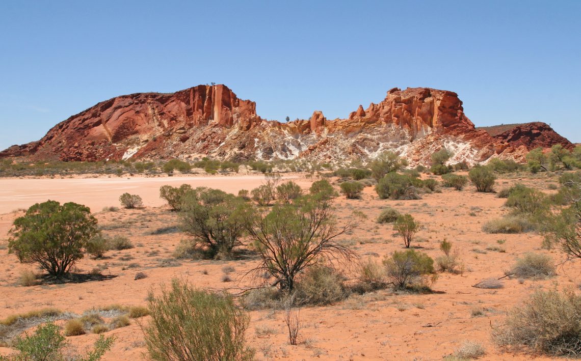
The Claypan Walk I is 1.6 km, the path crosses the claypan plain (typical bush shrubs) and along the way, panoramic platforms are overlooking the buttresses of the Rainbow Valley.
The dunes are spectacular and guarantee magnificent photos.
The second itinerary of about 1 km takes us to Mushroom Rock's sandstone formation. Here you can see the nests of wild martian martens, insectivorous singing birds very beautiful to behold. Rainbow Valley's majesty is appreciated at sunset and dawn when the sandstone amphitheater lights up with golden colors giving rise to a majestic spectacle of delight for photography enthusiasts.
Indicative kilometers traveled: 100 km
Type of road: Not difficult track / Asphalt road
Today's program;
Return to Alice Springs during the day and delivery of the vehicle.
Tariff per person, starting from:
| Departure | Double |
|---|---|
| From 1 April 2019 to 30 June 2020 | € 320 |
Notes
We recommend arriving the day before with an overnight stay in Alice Springs.
Trekking type: classic
Difficulty : easy / medium km per day: 7
Period/departures: from April to October – daily
Minimum / Maximum of participants: 2 / unlimited
The tariff includes
The tariff does not include

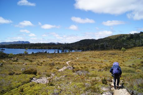
Overland Track in Australia The Overland Track is one of Australia’s most popular hiking trails, located in Tasmania‘s Cradle Mountain-Lake St Clair National Park. Officially, the track runs for 65 kilometers from Cradle Mountain to Lake St Clair, however many choose to add the stretch along Lake St Clair as a natural extension, thus reaching […]